


Live Satellite View, 3D Map
3.978.00 Reviews
App Specs
- Version
- 3.6
- Updated On
- License
- Free
- Downloads
- 100,000+
- Developer
- Banix Studio
- Categories
- Maps & Navigation
- Platform
- Android
Screenshots
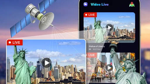
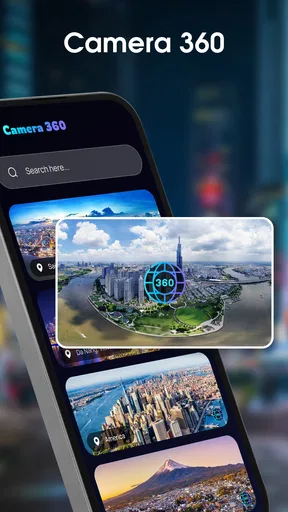
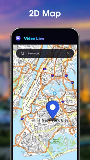
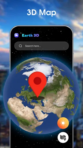
 Analysis by AppCompare
I approached Live Satellite View, 3D Map as a curiosity first and a navigation tool second. The idea is easy to understand: open a map, look at places from above, and use a more visual perspective than the usual street map. In practice, that makes the app immediately appealing when I want to inspect a neighborhood, revisit a memorable place, or get a broad sense of an area before going there. It is a free Android app from Banix Studio in the Maps & Navigation category, with a Everyone age rating and support for Android 7.0 and later.
My first impression was positive because the app gives map exploration a more visual, almost leisurely quality. A standard map is excellent when I already know what I need: a route, an address, or a nearby business. This app is more interesting when I am still forming a picture in my head. I can move around a location, compare surrounding roads and landmarks, and use the satellite-style view to understand how a place is arranged. That difference is important. It is not simply a replacement for every conventional navigation app; it is better understood as a visual companion for exploring locations.
What makes the first week enjoyable
During the first few sessions, the strongest appeal comes from discovery. I found myself opening the map for places I had no immediate reason to visit, simply because the overhead perspective made familiar and unfamiliar areas feel different. A park, coastline, large building, or dense residential block can be easier to understand when viewed as part of its surroundings rather than as a list of turn instructions.
That makes the app useful for planning in a loose, exploratory way. Before meeting someone in an unfamiliar district, I can look at the surrounding layout and identify the general shape of the area. Before choosing a walking destination, I can inspect whether the location appears connected to open spaces, major roads, or clusters of buildings. I would not treat this as a substitute for checking current travel conditions, but it can reduce the feeling of arriving completely blind.
The three-dimensional presentation also gives the experience more personality than a flat map. I do not think the visual effect alone is enough to justify keeping any map app installed forever, but it makes the first week more engaging. The app has a clear “let me look around” quality, and that is a genuine strength rather than a gimmick when I use it to build spatial awareness.
One practical habit helped me get more from it: I used the app before leaving home instead of trying to study an unfamiliar place while already walking. Looking at the wider area first gave me a better sense of the destination and made the later visit less dependent on constant screen checking. This is a small workflow, but it turns the app from a visual toy into a planning aid.
A realistic everyday scenario
Imagine that I am visiting a new part of town to meet a friend near a large public venue. A normal map can tell me the address and offer directions, but I may still not understand how the venue relates to nearby roads, open areas, or neighboring buildings. With Live Satellite View, 3D Map, I can first inspect the destination from above, look at the surrounding blocks, and form a rough mental map. When I arrive, I am not relying entirely on the blue route line to understand where I am.
Worth Reading Before You Choose

EA SPORTS FC Mobile 26 Is a Bigger Football Game, but It Takes Time

Flipboard Shows What News Apps Must Do Beyond the Feed

Switching to Android Auto Means Rethinking Your Driving Routine

Google Calendar Makes a Crowded Week Easier to Manage

Ludo King Makes the Most of the Minutes Between Plans

Baby Panda World Brings Quick Play to Modern Phones, but Its Game Library Feels Busy
This is especially helpful when the destination is visually confusing or spread across a large area. It can also help when I am deciding where to begin exploring rather than following a precise itinerary. The app’s value in that situation is not that it magically solves navigation; it is that it encourages me to look at the whole setting before focusing on a single road.
There is a trade-off, though. Satellite imagery and three-dimensional views can look convincing while still requiring common sense. A view from above does not guarantee that a path is public, that an entrance is open, or that the image reflects the current condition of a location. I treat the display as context, not as a promise about access. That distinction is one of the most important things to learn during the first week.
Where it differs from ordinary map apps
Compared with a mainstream turn-by-turn navigation app, this one feels less task-driven. Traditional navigation tools usually win when I need live route decisions, traffic awareness, transit details, business information, or a dependable arrival workflow. Live Satellite View, 3D Map is more attractive when the question is, “What does this place look like in relation to everything around it?”
That makes the two types of app complementary rather than interchangeable. I would use a conventional navigation service for a time-sensitive journey and this app for visual preparation, casual exploration, or checking the broader shape of a location. If someone wants one app to handle every transport situation, this is probably not the most sensible primary choice. If someone enjoys understanding places spatially, its different emphasis is worthwhile.
The app’s store summary presents it as a real-time window to the world, and that captures the intended mood, but I would not interpret that wording too literally. Satellite-style imagery should be viewed as a visual reference, not as a live camera feed. That expectation matters because it prevents disappointment when a recently changed road, building, or landscape does not appear exactly as it does today.
Does it still matter after the novelty fades?
After the initial curiosity wears off, the question becomes whether the app earns a regular place on my phone. My answer is conditional: it can, but mainly for people who repeatedly plan visits, explore geography, or prefer visual context over a purely functional route screen. For everyone else, the novelty may be strongest during the first few weeks and then settle into occasional use.
My month-to-month value comes from specific routines rather than constant daily navigation. I can use it when planning a weekend outing, checking the surroundings of a hotel or venue, revisiting a childhood neighborhood, or comparing several possible meeting areas. These are not dramatic use cases, but they are recurring enough to keep the app relevant when I deliberately make space for them.
A useful long-term approach is to open it with a question. Instead of aimlessly dragging around the map, I might ask: Which side of this district has more open space? How does this destination connect to the nearby roads? What does the surrounding area look like before I visit? That simple discipline reduces empty browsing and makes each session more purposeful.
I also found that the app works best as a pre-trip tool rather than a constant travel companion. Once I am moving, I usually want concise instructions and current route information. Before I leave, I have more patience to examine the surroundings and make decisions. This division of labor gives the app a durable role without forcing it to compete directly with navigation tools designed for live journeys.
Who is likely to keep using it?
I think it is a good fit for travelers who like to preview destinations, students learning the layout of a new city, property viewers who want a broad visual impression of an area, and curious users who enjoy exploring maps without a fixed route. It can also suit people who find a satellite perspective easier to understand than a dense collection of street labels.
It is less suitable for someone whose main requirement is dependable step-by-step guidance. Drivers, delivery workers, commuters, and anyone making decisions under time pressure may prefer a dedicated navigation app with a workflow built around immediate routing. The same applies to users who need highly current local details and do not want to interpret imagery themselves.
Families may appreciate the Everyone rating, since the concept is straightforward and broadly accessible. Still, the app is more useful when the user understands that map imagery is an aid to orientation, not a guarantee of real-world conditions. That is a small lesson, but it affects how responsibly the app is used.
Maintenance and the small costs of keeping it useful
The maintenance burden is not heavy in the traditional sense, but it is easy to underestimate. A map exploration app needs to remain relevant through updates, and the current version is 3.6. I pay attention to whether the experience stays smooth and whether the visual presentation continues to justify opening it instead of using a familiar map service. If an app is installed but I never develop a repeatable reason to use it, it becomes clutter rather than a tool.
The free price makes experimentation easy, although in-app purchases range from around two dollars to around ten dollars per item. That means I can try the basic experience without committing money immediately, but I would still think carefully before paying for extras. The right question is not whether an optional purchase makes the app more impressive for a few minutes; it is whether it improves a recurring workflow I will actually use.
Storage, battery use, and data consumption are also practical considerations whenever a map app displays detailed imagery. I avoid extended visual browsing when I am relying on a limited connection or when my phone is already low on power. I also prefer to do exploratory sessions before a trip, when I can take my time and avoid turning a visual feature into an unnecessary drain during travel.
One maintenance habit I recommend is reviewing the app after a few real trips rather than judging it only by the first exciting session. Did it help me understand a destination? Did I return to it for a clear reason? Did it complement my usual navigation app, or did I simply open it to admire the view? Those answers reveal whether it deserves permanent space better than the initial impression does.
Where fatigue begins
The main source of fatigue is repetition. Looking at a satellite or three-dimensional map is engaging when I am discovering something, but less so when I am moving around without a purpose. After enough casual exploration, many locations begin to feel visually similar, and the app’s central attraction loses some of its force.
Another possible frustration is the gap between visual confidence and practical certainty. A clear overhead view may suggest a simple route or an obvious entrance, but the image does not replace signs, access rules, current closures, or local knowledge. Users who expect the app to answer all of those questions may find it limiting. I see this less as a defect in the concept and more as a boundary that needs to be understood.
The app can also feel secondary when I already have a familiar mapping service that combines directions, search, traffic, and place information. Switching between apps adds friction, especially for short journeys where I do not need a broad visual preview. For me, the strongest case for keeping this one is not convenience in every situation; it is the distinct perspective it offers when ordinary map information feels too abstract.
There is a further trade-off between detail and simplicity. A visually rich map can help me understand an area, but it can also tempt me to spend time inspecting details that do not affect my plans. I get better results when I decide in advance how much I need to know. A quick orientation check is often more useful than a long session of aimless zooming.
My long-term verdict
Live Satellite View, 3D Map has earned a place as an occasional visual planning tool, not as my only navigation app. Its first-week appeal is real, and its month-to-month value survives when I use it for destination previews, geographic curiosity, and broad spatial understanding. The experience is most rewarding when I want to see how a place fits together rather than simply reach it as quickly as possible.
Banix Studio has made an app that is easy to approach and free to try. Its average rating is about 3.9 from over 500 ratings, with more than 70 written reviews, while its install count has passed 100 thousand. Those figures suggest a meaningful audience, but they do not decide whether it will become part of my routine. The lasting test is personal: do I regularly have situations where a visual map adds something my usual navigation app does not?
For me, the answer is yes, but only in a supporting role. I recommend it to anyone who enjoys exploring places from above or likes to prepare visually before visiting somewhere unfamiliar. I would skip it as a primary choice if my priority is live directions, fast route changes, or an all-in-one travel assistant. The app earns lasting value through purposeful preparation, not through endless map browsing.
That is ultimately why I would recommend trying it without promising that everyone will keep it installed. The novelty opens the door, but habit decides whether it stays. If you build it into a simple routine—preview the destination, understand the surroundings, then switch to your regular navigation tool when the journey begins—it becomes a focused and useful companion. Without that routine, it may gradually become an attractive app that I open only when curiosity briefly returns.
Pros
- Real-time satellite imagery makes exploring locations feel more immersive.
- 3D terrain provides a clearer sense of elevation and surrounding landscapes.
- Search tools help users locate cities
- landmarks
- and points of interest quickly.
- Useful for planning trips and previewing unfamiliar areas before visiting.
- Smooth map navigation makes zooming
- rotating
- and panning easy on mobile devices.
Cons
- Imagery quality and update frequency vary significantly by location.
- Detailed 3D views may require a capable device and consume more battery.
- Some features may be limited without an internet connection.
- Map data can be less accurate in remote or newly developed areas.
- Advertising or in-app purchases may interrupt the viewing experience.
FAQs for Live Satellite View, 3D Map
What is Live Satellite View, 3D Map used for?
Live Satellite View, 3D Map is designed to help users explore locations through satellite-style imagery, map views, and three-dimensional representations of roads, landmarks, and terrain. During testing, it felt most useful for browsing unfamiliar areas, checking surrounding geography, and planning routes visually. It should be viewed as an exploration and reference tool rather than a replacement for a dedicated navigation app.
Does Live Satellite View, 3D Map show real-time satellite images?
Despite the word “Live” in its name, users should not assume that the application provides continuously updated, real-time satellite footage. Satellite and map imagery is generally collected, processed, and updated periodically by mapping providers. The exact freshness and coverage can vary by location, so the app is better suited to viewing available map imagery than monitoring live events or current conditions on the ground.
Does the app require an internet connection?
An internet connection is normally needed to load satellite imagery, map tiles, three-dimensional views, search results, and location information. Performance may depend on the quality of your Wi-Fi or mobile data connection, especially when zooming into detailed areas or switching between viewing modes. Before traveling, check whether the app offers any offline features, because full map availability without connectivity should not be assumed.
Is Live Satellite View, 3D Map accurate enough for navigation?
The app can be helpful for visually examining an area and understanding the layout of streets, buildings, and natural features, but it may not provide the same navigation tools as specialist GPS applications. Map data, imagery dates, road information, and location accuracy can differ between regions. For driving directions, traffic updates, turn-by-turn guidance, or emergency decisions, users should confirm information with a trusted navigation service.
Is Live Satellite View, 3D Map free and safe to use?
Availability and pricing can depend on the version downloaded from the Android or iOS store. Some features may be free while advertising, subscriptions, or optional purchases can apply, so review the store listing before installing. You should also examine the requested permissions and privacy policy, particularly any access to location data. Downloading from an official app store is the safest way to obtain the legitimate application.


